Hike, bike, e-bike: our selection of “elevation gain” challenges to spice up your summer!
One day, Santa brought you a smart watch. And ever since, you can’t help but check your performances every time you go on a sports outing! We understand, it’s so tempting. So, here are a few hike/bike/e-bike ideas to help you reach the positive elevation gain that you’re aiming for this summer... You can do your digital detox another time!
Warm up your thighs on a road bike
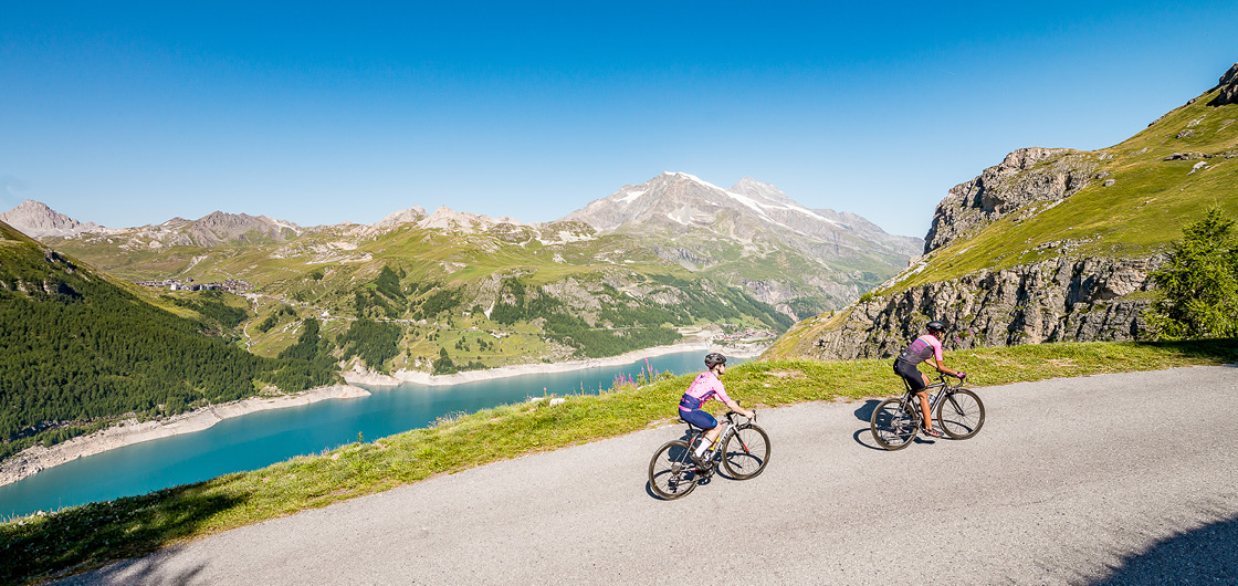
- The “Machine!” option: from Tignes 2100, go to Tignes 1800 then cross the dam and turn right towards Val d’Isère (lights essential for your safety in the tunnels). The warm-up continues with a false flat up to the Saint Charles bridge. From there, begin the climb up the Col de l’Iseran mountain pass (the highest road pass in Europe!). Not had enough yet? Go back down on the Maurienne side until Bonneval-sur-Arc (listed among the "Loveliest Villages in France”)... and go back up again to the Col de l’Iseran mountain pass for twice the pleasure! Go back to Tignes via the same route. On the meter: An elevation gain of 1275 m (or 2230 m if you go down to Bonneval).
- The “We aren’t here to suffer” option: settle for the Tignes climb, between Brévières (1550 m) and the Val Claret (2100 m). A more feasible challenge but which will still leave bicycle enthusiasts’ thighs sore, if they’re only beginners. On the meter: An elevation gain of 540 m.
Discover all the cycling itineraries around Tignes..
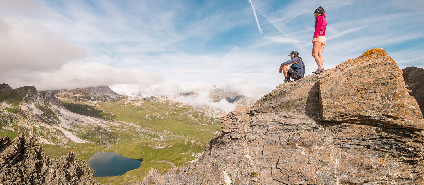
The highest hike in Europe, if only for that!
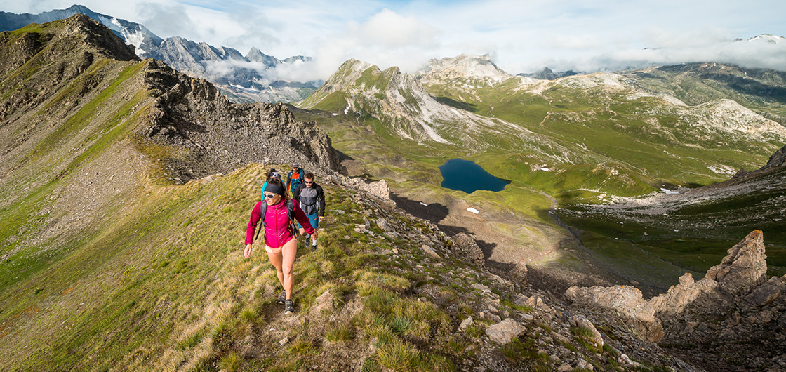
Begin your climb on the grassy slopes which overlook the Saut car park (above the hamlet of Le Franchet) before committing to a more mineral universe as you get closer to the long ridge that will take you to the Aiguille de la Grande Sassière. Listen and open your eyes: you may hear the chamois or Alpine ibex jumping across the rocky (and steep!) slopes to your right. You’ll need your mental and cardiac strength for the last part of your climb in the screes. A tip: don’t look up, just place one foot in front other other and let yourself be blown away by the view when you get there! From the platform at an altitude of 3747 m, a stunning 360° view over the French, Italian, and Swiss mountains awaits you. On the meter: An elevation gain of 1465 m.
Alternative: for a more accessible 360° point of view, climb up to the toposcope of l’Aiguille Percée, certainly one of the most photographed geological phenomena in Tignes, in both summer and winter. From above, admire la Grande Motte, la Grande Casse, la Grande Sassière, Le Chevril lake, la Sache, the suspended glacier... Simply wonderful! On the meter: An elevation gain of 610 m (departure: Tignes Lake).
extra info
The Aiguille Percée can be found on the 27 km and 44 km routes of the Tignes Trail! An extra challenge if you feel up for it after your exploratory hike...
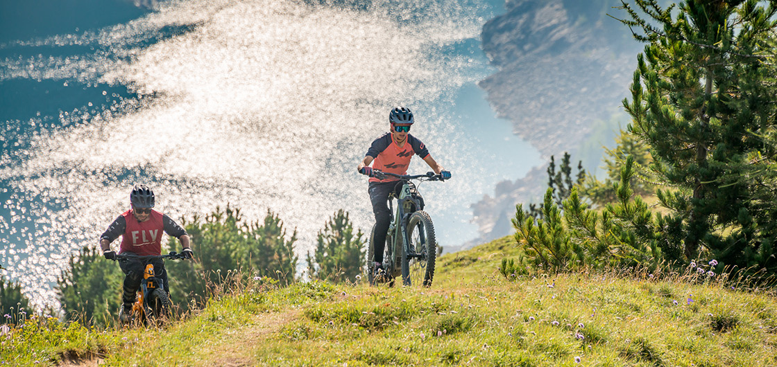
Departing from Tignes Lake, take the Chardon’Up electric mountain bike path (red / experienced level) until you get to the Tichot ski lift. Turn left and follow the signs of the “Dark Jadore” (black / expert level) slope up to the Col du Palet mountain pass. Enjoy taking a peak over to the other side: you’re at the gateway to the Vanoise National Park! It’s now time to come back down towards the Chardonnet lakes (obligatory photo break) then towards Tignes Lake via the Chardon’Up and Smoothie slopes (beginner level downhill slope). On the meter: An elevation gain of 630 m.
Would you prefer a more accessible challenge with your family? Departing from Tignes Lake again, follow the Cow Lanta (blue / intermediate level) slope. It will take you to #TIGNES with an impressive view of Chevril lake. Share your photos on Instagram with #tignes and @tignesofficiel: they may be shared by the community manager! On the meter: An elevation gain of 320 m.
A few tips that make a difference:
- It is often colder at higher altitudes! Take something warm (especially at the top of the Col de l’Iseran mountain pass or at the peak of the Grande Sassière, where a hat and gloves may be useful, even in August)
- Don’t be overzealous about the weight of your bag: don’t skimp on water and essential snacks (cereal bars, fruit jellies, etc.). You don’t want to be lacking in energy on the way up!
- Take someone with you (or share your itinerary with a friend)
- Always bear in mind that the elevation gain challenge is a game! Not feeling great? Turn around and try again another time rather than risk hurting yourself (or risk your morale taking a hit). Strava will always be here tomorrow